Resources Overview
Since our formation in 1996, Norman Creek Catchment Coordinating Committee, in partnership with Brisbane City Council, has initiated a large number of projects in the Catchment. Some of these are ongoing and others are in a maintenance phase.
As a partner in BCC’s Norman Creek Catchment 2012-2031 Master Plan, N4C has developed strategic concept plans for areas within our catchment and submitted them to the Council. These are available for download from our Project site pages below, or from Strategic Plans.
You can contribute to these community-driven projects in many ways: becoming a member, active volunteering on site, technical expertise, financial support or even being our eyes and ears in the community. Browse through our project pages and check our Google Map of Project Sites, and you might find one that’s near you!
Aerial Imagery
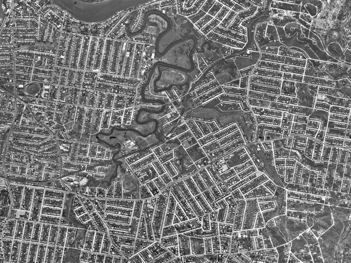
The story of Norman Creek has been, and remains, one of dramatic change. One of the most valuable records of Brisbane's history is the set of aerial photographs taken in 1946. These are among the first aerial photographic records of Brisbane, and they cover almost ... read more
Baseline Ecological Monitoring
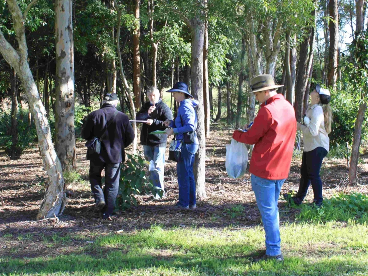
N4C has been conducting Baseline Ecological Monitoring at a number of sites in the catchment. The goal of this work is to be able to track long-term changes in the catchment, to gauge the effect of our work and the effects of development or other events. It's one ... read more
Interactive Catchment Map
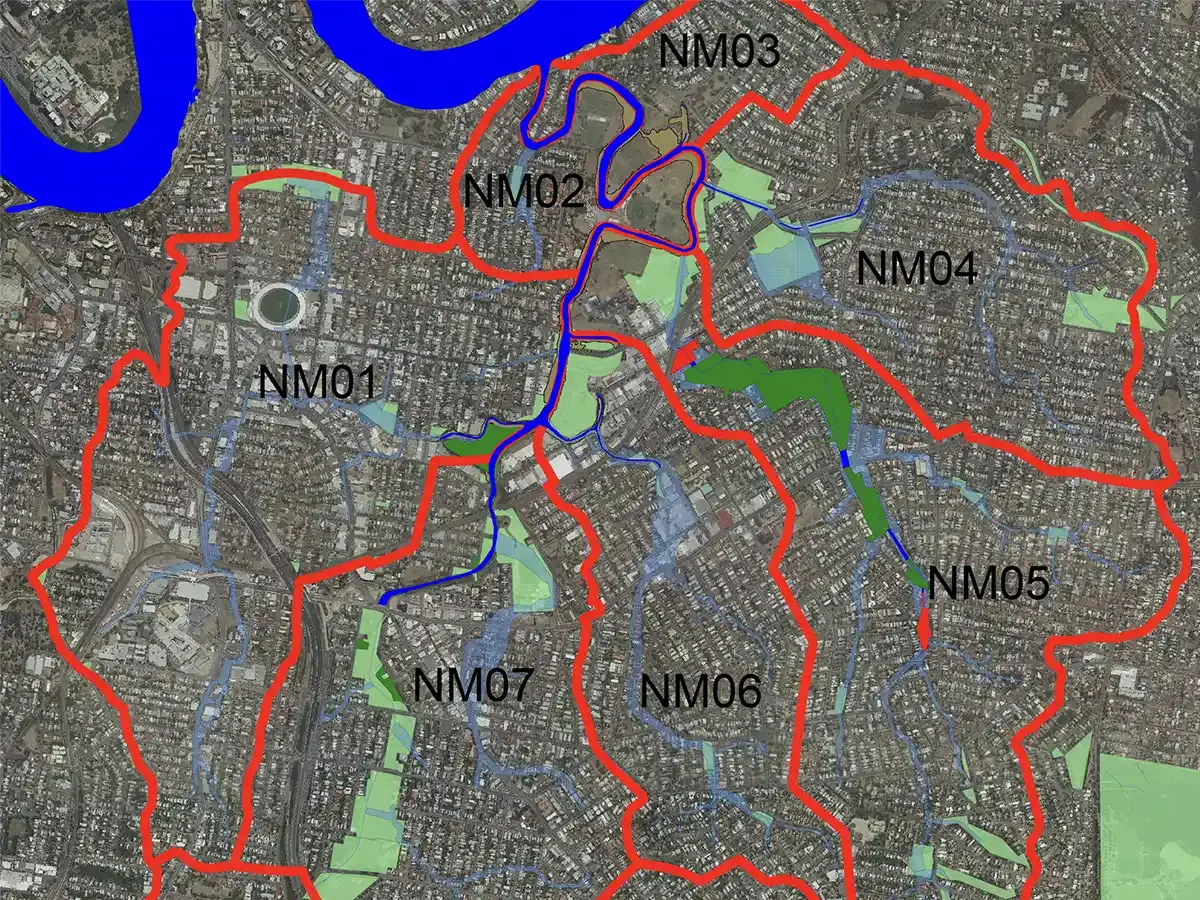
Norman Creek Catchment Coordinating Committee presents a comprehensive interactive map of our catchment area. The map was developed by Lisa Weber of Precision Management Solutions. It highlights the different sub-catchments belonging to the 12 tributaries of ... read more
Navigating Norman Creek Videos
"Navigating Norman Creek" is a collection of five short films and one visual poem by Griffith Film School historian and filmmaker Trish FitzSimons, which was exhibited at Museum of Brisbane from 19th June to 11th October 2015. This work was partly funded by a ... read more
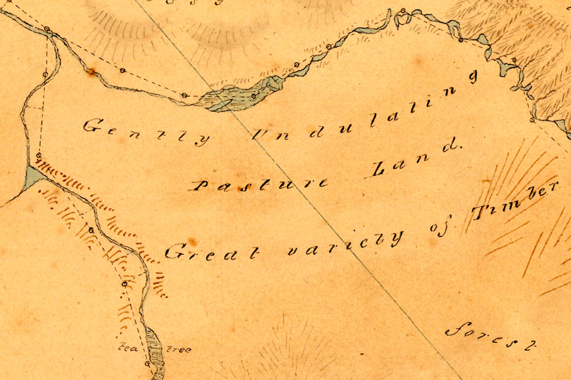
Navigating Norman Creek: Maps from 1839 and 2015
Following John Oxley’s surveys of the Brisbane River and its environs in 1823 and 1824, the city of Brisbane began as a penal colony, established initially at Redcliffe in 1824 and moved to the site of the present CBD in 1825. Only when the penal colony started to ... read more
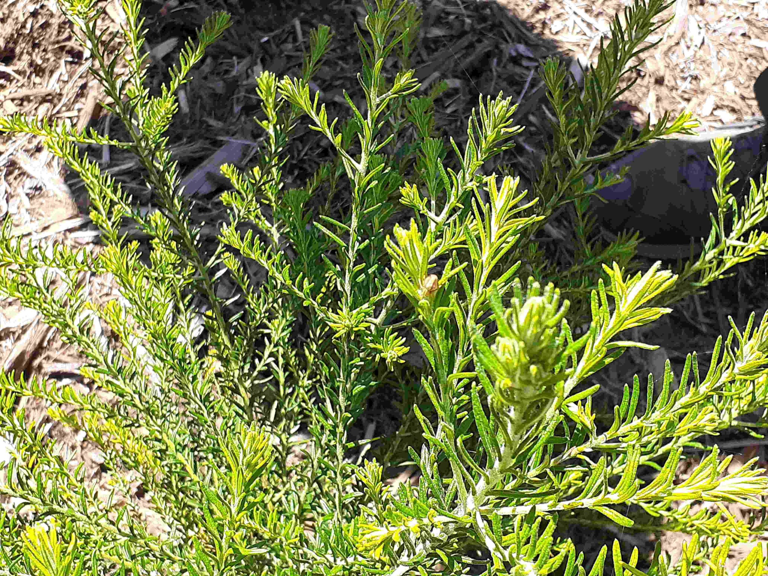
Plant Information
The list of plants below relate to our Rome St project have been selected based on a number of factors: Qld Regional Ecosystem Framework Technical Description Historical changes to the soil profile Suitability to local residents Availability at ... read more
Useful Links
Websites of related organisations. For example Catchment / Environment / Wildlife Groups include links to, Bayside Creeks Catchment Group, Brisbane Catchments Network, Bulimba Creek Catchment Coordinating Committee, Centenary and District Environment Action, ... read more